Search  for anything...

Garmin 010-00970-00 eTrex 10 Worldwide Handheld GPS Navigator

  • Based on 6,371 reviews
Condition: New
Checking for the best price...
$149.90 Why this price?
Save $4,850.09 was $4,999.99

Buy Now, Pay Later


As low as $24.98 / mo
  • – 6-month term
  • – No impact on credit to apply
  • – Instant approval decision
  • – Secure and straightforward checkout

Ready to go? Add this product to your cart and select a plan during checkout.

Payment plans are offered through our trusted finance partners Klarna, Affirm, Afterpay, Apple Pay, and PayTomorrow. No-credit-needed leasing options through Acima may also be available at checkout.

Learn more about financing & leasing here.

Free shipping on this product

FREE 30-day refund/replacement

To qualify for a full refund, items must be returned in their original, unused condition. If an item is returned in a used, damaged, or materially different state, you may be granted a partial refund.

To initiate a return, please visit our Returns Center.

View our full returns policy here.


Availability: Only 10 left in stock, order soon!
Fulfilled by Amazon

Arrives Mar 30 – Mar 31
Order within 23 hours and 30 minutes
Available payment plans shown during checkout

Protection Plan Protect Your Purchase
Checking for protection plans...

Features

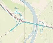
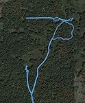
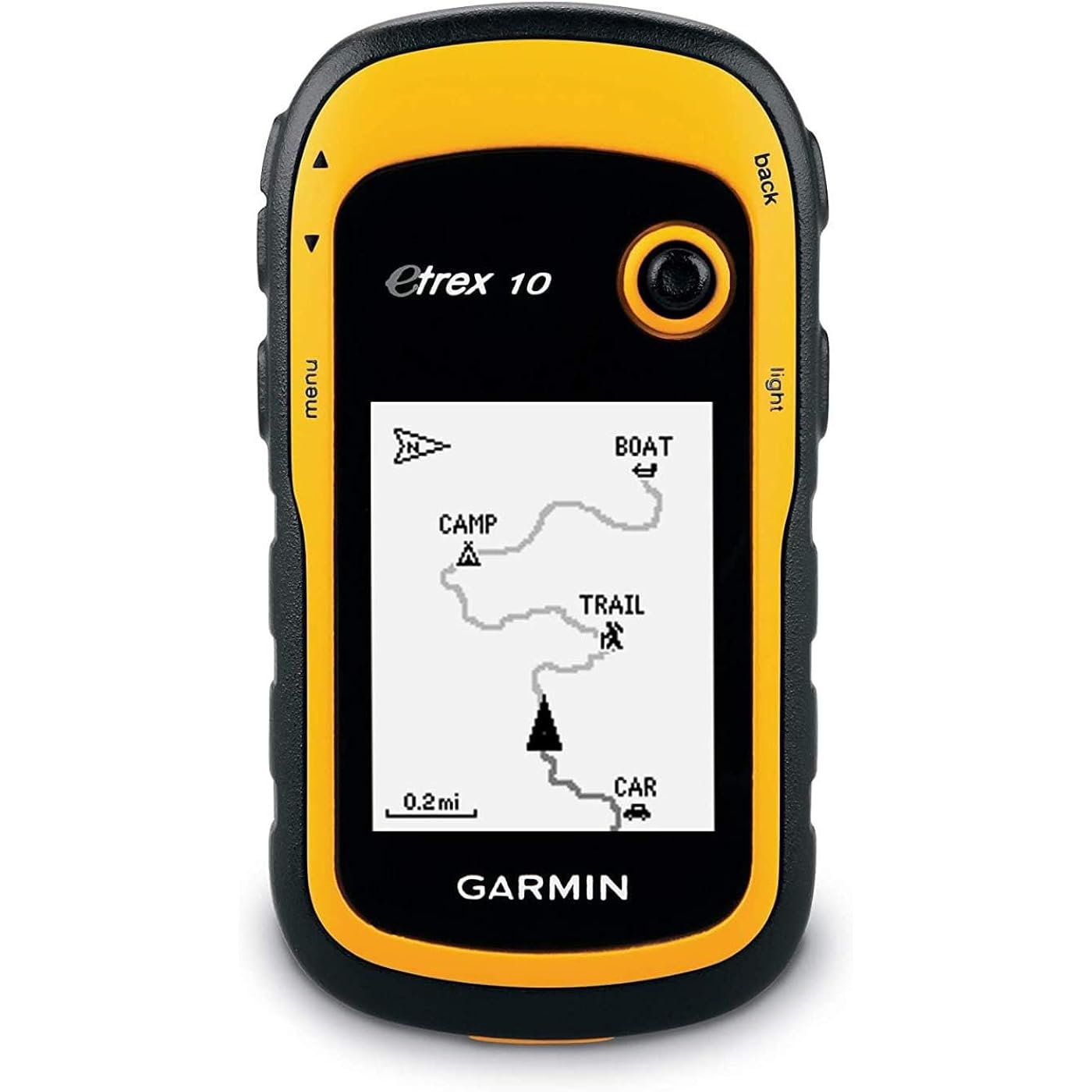
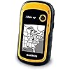
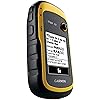
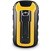
  • Rugged handheld navigator with preloaded worldwide basemap and 2.2 inch monochrome display
  • WAAS enabled GPS receiver with HotFix and GLONASS support for fast positioning and a reliable signal
  • Waterproof to IPX7 standards for protection against splashes, rain, etc.
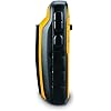
  • Support for paperless geocaching and Garmin spine mounting accessories. Power with two AA batteries for up to 20 hours of use (best with Polaroid AA batteries)
  • See high and low elevation points or store waypoints along a track (start, finish and high/low altitude) to estimate time and distance between points

Description

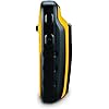
The eTrex 10 makes a great choice in handheld navigation for the budget savvy outdoor enthusiast. This eTrex model is equipped with a high-sensitivity GPS receiver, a 2.2-inch monochrome display, and a worldwide basemap making it easier than ever to see where you are and where you have been. Garmin Connect compatible (online community where you analyze, categorize and share data).

Brand: Garmin


Model Name: eTrex 10


Vehicle Service Type: Car, Truck, Motorcycle, etc.


Screen Size: 2.2 Inches


Special Feature: Paperless Geocaching, Track More Satellites


Connectivity Technology: USB


Map Type: Australia


Included Components: eTrex 10, Lanyard, USB cable, Manual


Audio Output Mode: Digital


Battery Life: 20 Hours


Compatible with Vehicle Type: Car, Truck, Motorcycle, etc.


Screen Size: 2.2 Inches


Additional Features: Paperless Geocaching, Track More Satellites


Connectivity Technology: USB


Map Types: Australia


Sport Type: Running


Audio Output Mode: Digital


Battery Average Life: 20 Hours


Mounting Type: Spine mounting


Resolution: 128 x 160


Operating System: Garmin


Memory Storage Capacity: 6 MB


Touch Screen Type: Resistive


Display Type: LCD


Human-Interface Input: Buttons


Compatible Devices: Touch devices, computers and generally any device that can use USB connectivity or global map


Control Method: Touch


Are Batteries Included: No


Supported Satellite Navigation System: GPS


Connectivity Protocol: wired


Brand: Garmin


Model Name: eTrex 10


Built-In Media: eTrex 10, Lanyard, USB cable, Manual


Model Year: 2011


UPC: 753759975845


Global Trade Identification Number: 45


Manufacturer: Garmin


Item Type Name: Garmin eTrex 10 Worldwide Handheld GPS Navigator


Unit Count: 1.0 Count


Warranty Description: 1 year limited


Item Dimensions L x W x H: 2.13"L x 1.3"W x 4.06"H


Item Weight: 141.7 Grams


Frequently asked questions

If you place your order now, the estimated arrival date for this product is: Mar 30 – Mar 31

Yes, absolutely! You may return this product for a full refund within 30 days of receiving it.

To initiate a return, please visit our Returns Center.

View our full returns policy here.

  • Klarna Financing
  • Affirm Pay in 4
  • Affirm Financing
  • Afterpay Financing
  • PayTomorrow Financing
  • Financing through Apple Pay
Leasing options through Acima may also be available during checkout.

Learn more about financing & leasing here.

Top Amazon Reviews


  • Still great after almost four years!
Desperate for an inexpensive GPS unit, I bought this late in 2014. At first, its logic took some getting used to, for the track record is always on, and you have to clear the active track to start a new one. Not a big deal, because of course you can save the track before deleting it. Also, the "back" button seems to be the simplest way to move through menus. This unit replaced a series of an older inexpensive Garmin model, which lived up to their reputation of failing every two years or so, though they were fine up to the failure point. Anyway, after almost four years of extensive use and the occasional drop, my eTrex 10 is still getting the job done really well. The display is old-style plain, not for everyone, but this translates into superb battery life. I can run it all day on a fresh pair of rechargeable AA's without any fear of data loss. The accuracy of handheld GPS units is hard to pin down--smoke and mirrors, but this one certainly does the job for road logs and hiking records. Sensitivity is excellent and it doesn't take long to find satellites. Downloading tracks is easy and dependable, something I can't say for my old Garmin Forerunner 305 wrist GPS. When connected to a USB port, the eTrex 10's track and waypoint data appear in a virtual drive folder, for easy copy or upload to GPS software. All I want from a GPS device is reliable information on where I am and where I've been, for I depend on mapping software to deliver actual graphics. Users who want better mapping support from the unit itself would find the eTrex graphics too limited. Also, I don't go after geocaches and can't evaluate the unit for that. But the eTrex 10 is just fine for locating myself in trackless woods, for providing a work record of where I've been, and for keeping track of my auto travel details. I did have one tense moment when, for failture of housekeeping, the track memory became so full that there didn't seem to be enough left to run the track deletion sequence. Can't remember how I got around that; maybe by starting with the smallest tracks. Didn't want to do a complete reset because there was some information I had not downloaded. ... show more
Reviewed in the United States on August 6, 2018 by dhillier38

  • Great GPS, albeit small internal memory
This GPS works very well and lasts a very long time on a single pair of alkaline AA batteries. My primary purpose is geotagging photographs, but it's handy to get around and measure distances, as well. With GLONASS and WAAS activated, this receiver locks on incredibly quickly, even if it hasn't been turned on in a couple weeks, and it's very accurate (down to 8 feet in open areas). The screen is monochrome and is highly readable in direct sunlight, which is a huge bonus over color models. A carabiner clip is sold separately, but you could fasten a zip tie to one as well. For the geography buffs, you can also change the map datum to whatever format you need, including the standard WGS84, NAD83, and GRS80, as well as change the coordinate system to most conceivable combinations of degrees, minutes, and seconds, as well as decimals of degrees or minutes. You can also save plenty of waypoints to save your favorite locations (or find your way back to your car). The biggest caveat is the miniscule 8 megabytes of internal memory compared to other GPS receivers that sport several gigabytes of storage. However, you can download and convert OpenStreetMap portions to put your local area into the device before going on a trip to get access to street and trail maps, which are very handy when you don't want to fiddle with a paper map. (There's no topography, though.) However, as mentioned at the start, I use this device to geotag photos taken with my camera, and it generates standard GPX files, which can be saved on the device to split up your current trek as you please. As long as you keep your camera's clock in sync with the clock on this receiver (be careful if using near daylight-saving time transitions), it will work with software like GeoSetter, Lightroom, and Picasa, and it works with any digital camera that stores the date and time the photo was taken. ... show more
Reviewed in the United States on December 16, 2015 by Cat

  • NO MAPS BUT LOT'S OF USEFUL INFORMATION AND TRACKING WHERE YOU'VE BEEN
This works well. Its only downside is that it dosen't show a map. I does draw a line on the screen so you can back to where you were. There are additional screeens that show interresting information. How many miles walked. How long you were moving, how long you stopped. Average speed walked. Most important to me is the time that the sun will set and the time that it will rise. ... show more
Reviewed in the United States on January 25, 2026 by petenow

Can't find a product?

Find it on Amazon first, then paste the link below.
Checking for best price...